On November 11, 2023 the JCB Center and Faulkner County Museum were notified by Dr. Ben McNew that the historic Home Economics Building (build October 8, 1929) on the property of the Centerville United Methodist Church was beyond repair and was scheduled to be razed in December 2023. We agreed to visit the site and document the building and property. All buildings and features on the property are associated with the Centerville Community and date to the late 1920s – early 1930s. It is historically significant as a long-lasting community church, as well as its contributions to Camp Halsey (3FA313), of which young men would walk from the Camp to the Church to attend classes within the Home Economics Building.
The earliest structure, the original Union Grove Methodist Church, was a wood frame structure constructed in 1916. It serves today as the Centerville United Methodist Church. In 1914, after a fire destroyed the Woolly School, a two-room school was built approximately a mile to the northeast at the site of the present-day Centerville Methodist Church. The new school was called Union Grove, and provided instruction for grades 1 through 6. Around 1922 the school was renamed Centerville, and by 1927 two more rooms were added to the building. The late 1920s witnessed several school consolidations. By 1928, the schools at Enders, Fairview, White Oak, Cadron Valley Happy Valley and McGintytown consolidated into the Centerville Campus. A high school was established in 1928, and a Smith-Hughes agricultural building was constructed at that time. Classes graduated from the senior high between 1930 and 1952. In 1952 the district was split, with the northeast portion entering the Quiltman School District and the Southwest portion consolidating with Greenbrier.

Centerville United Methodist Church Building
East of the church is the Home Economics Building. A small well-house is to the east of the Home Economics Building. A large community storm shelter is located on the south end of the property. Numerous trees contain circular mortared stone features that would have been gardens. Some are in the open grass area, and several can be seen extending into the wooded overgrowth. Various stone paths, with borders, connect buildings, but most have been covered over the years by natural soil and leaf accumulation.

Remains of the Home Economics Building
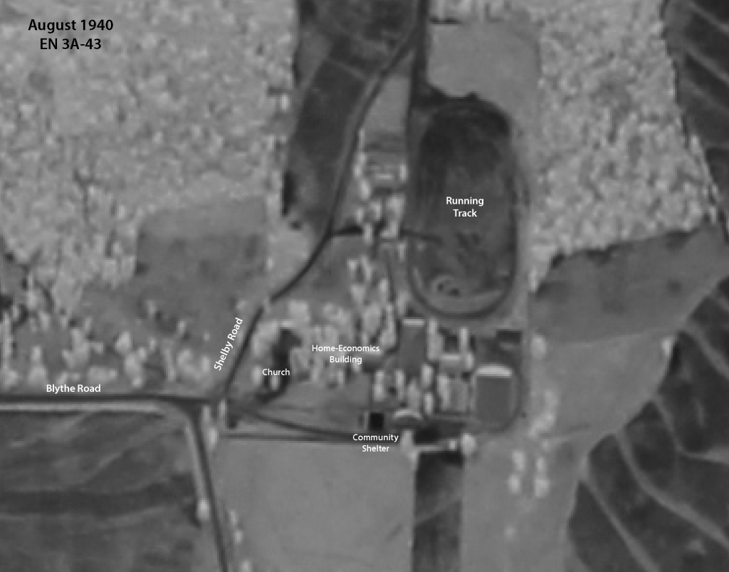
Within the wooded overgrowth east of the property is the remains of a large circular running track. Stone borders delineate a raised and level track that was used by the community. Its extent is visible on an August 1940 aerial image, along with several additional features that are buried within the wooded area and have not been documented.

Location of buildings and features associated with the CentervilleUnited Methodist Church property, dated August 1940.
Between 1935 and 1944 all of the existing buildings were remodeled and several new buildings were constructed. In 1938 the Works Progress Administration (WPA) did stone siding on all of the buildings. By 1940 the campus included an auditorium, a gymnasium, grade school building, agriculture and home economics building, commercial building, and a storm shelter with a capacity for 500.

Storm Shelter
